Saturday, March 3, 2007

A Ride From L'Escala to L'Estartit on the old road (Muntanya Gran)


Taking advantage of the amazingly warm and sunny weather this Winter we took the bikes out for a run over the Muntanya Gran route from L'Escala to L'Estartit. This is a wonderful stretch of the Costa Brava that has remained unspoilt and is now a protected natural area. The road can be accessed from the Avinguda Montgò to the south of L'Escala (the resort area as opposed to the old town). Take the Avinguda Montgò and turn right when you see the signs for Camping Neus. Follow the road past the camping and on up the hill. After a few kilometers of surfaced road through lovely woods the road becomes a hard track that winds up the hill. On your left you will see some old military buildings that became a Buddhist community in the sixties and have now been left to the wind and sun. There are many routes through the Muntanya and hours of trails for walkers some of which plunge down steep bluffs and lead to tiny coves--the perfect spot for a quick swim and a picnic lunch. The climb up is pretty steep in the hot sun though so make sure you keep some water for the return journey.

The views are particular lovely from the GR route because from this high point you can see the sea. The larger and flatter old road is a pleasant ramble through woods and over the top till you can see the bay of L'Estartit on the other side.

My favourite view though is back across the fluvial plain of the Empordà where snowcapped Canigou seems to loom directly over Figueres (a trick of perspective).


It is a perspective that brings home the sweep of history as it draws together the Languedoc and Catalunya in a single canvas over the centuries of war and peace, conquest and adventure. I can observe the same mountain pass where Hannibal rode north with his elephants to conquer the world and the mountains where the kings of Aragon built castles such as Peyreperteuse and Quéribus (near Perpignan) to defend their realm against the French to the north.

Wednesday, February 7, 2007

Hill Walking and Hiking in the Alt Empordà


The Albera range. A nature area of national interest


The Albera range is the name given to the eastern end of the Pyrenees that runs from El Pertús to the sea. It is a region with a well-defined personality, a typically Mediterranean landscape and ecology. It separates the wide Empordà plain from the Roussillon lowlands, and part of the French-Spanish border has run along the crest of this range since the Treaty of the Pyrenees was signed in 1659. The Albera range is about 25 km long and its highest peaks are Puig Neulós (1257 m), Puig dels Pastors (1167 m), Puig dels Quatre Termes (1127 m) and Pic de Sallafort (975 m). At the seaward end the hills become gradually lower, the eastern tip being no more than a very rugged stretch of coast with high cliffs. The Albera belongs to the part of the Pyrenees composed of granite and schist rocks of metamorphic origin. These are low mountains and the passes are easily negotiated so that they have served as thoroughfares for countless generations. There are areas with spectacularly beautiful mountain landscapes of granite rock.


Information and visits

Entry to the nature area is free of charge. However it is advisable to call in first at the Centre d'lnformació del Paratge Natural, located in the former presbytery of the village of Espolla (c/ Mossèn Amadeu Sudrià, s/n, 17753 Espolla. Tel. 972/ 54 50 39). Information is also available from:

Rabós d'Empordà town hall (Tel. 972 563082)

Espolla town hall (Tel. 972 563179)

Municipal Tourist Office, La Jonquera (Tel. 972 554005)

The Biblioteca Municipal Carles Bosch de la Trinxeria (c/ Major, 101, 17700 la Jonquera. Tel. 972 554338) has a section devoted to documentation, studies and bibliography on the Albera range.

Route maps availabe from the information centre in Espolla. (That's the one I know anyway).

Els Alberes : a bit of history

The need to protect certain ecosystems in the Albera range was acknowledged in a plan drawn up in 1931 by the pre-Civil War Catalan Generalitat (autonomous government). However, it was not until 10 March 1986 that the present Catalan parliament passed a law making certain parts of the southern side of the range in the north of the Alt Empordà a nature area of national interest. The total surface area of 3428 hectares is divided into two sectors. One is the Requesens-Baussitges sector (12 639 ha), which stretches from Pic de Llobregat to Pla de les Eres and comprises the headwater valley of the Anyet river (in the borough of La Jonquera) and the upper Orlina valley (Espolla). The other is the Sant Quirze-Balmeta sector (789 ha) which runs from Puig de la Calma to the Teixó Col and includes the Sant Quirze valley (Rabós d'Empordà). Requesens castle, which was entirely restored at the end of the 19th century by the Rocabertí family, and part of the ancient borough of Baussitges, are in the former, and the imposing ruins of the former monastery of Sant Quirze de Colera are located in the latter area.


The protected area includes two partial nature reserves. One, located at the head of the Orlina river, covers an area of 395 ha and affords protection to the beech and oak woods between the Col of Els Emigrants and Pic de Sallafort, the most easterly of their kind on the southern side of the Pyrenees. The other, between the Sant Quirze valley and the source of the Valleta, occupies 580 ha. Its function is to protect various reptile species, notably the Mediterranean tortoise (or Hermann's tortoise). This second nature reserve was enlarged in 1987 by the addition of a further 680 ha lying beyond the south western boundary of the nature area. Another nature reserve, the wood of La Maçana, is located between Puig dels Quatre Termes and Pic de Sallafort on the northern slope of the range, which is under French administration.


Sant Quirze de Colera Monastery

Sunday, February 4, 2007

A Village House


The house was built some time in the 18th century and was a farmhouse until the previous owners left. It was completely remodelled in 2003 conserving the vaulted ceilings and stone walls on the ground floor. a>

These thick stone walls create a cool retreat in the warm months.


The first floor, which is the main living area, is notable for its exposed beams and original tiled floors. The kitchen and bathroom have, however, been completely renovated to provide modern comfort.


Autumn in the Alt Empordà


The lovely Romanesque church at Sant Tomás


Peaches galore on the Sant Tomás road


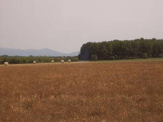
Fields after the harvest


Pines at Sant Marti de Empuries

Friday, December 22, 2006

The house is located in Torroella de Fluvià, a typical agricultural village just 5 km from the Costa Brava, a friendly and convenient location in which to enjoy village life and pleasant walks in the surrounding fields and countryside. The informal local restaurant has a well-earned reputation for typical Ampurdan dishes at local prices. We also have a shop selling village-raised chicken and rabbit as well as delicious sausages and charcuterie made on premises.

Sea kayaking : Cap de Creus (Girona)

Cap de Creus was constituted in 1998 by the Catalan government as a maritime/land Natural Park, thereby protecting this whole unique area, both land and sea. A great way to get to know this wild and rugged coast is by kayak. There are several companies that offer 1 and 2-day tours for experienced kayakers interested in exploring this coast. We have no information about which companies are the best so paddlers will have to make up their own minds on that score. http://www.kayakingcb.com/angles/text/exc/portlligat.htm http://www.skkayak.com/principal1.htm

Hoopoe

Hoopoe
Seen in the fields around Torroella